Florida Inlet Watch
Ebb current against swell and wind, at Florida's inlets and passes · Gansoft
iPhone and Android · free, with an optional yearly forecast subscription · QR codes to print
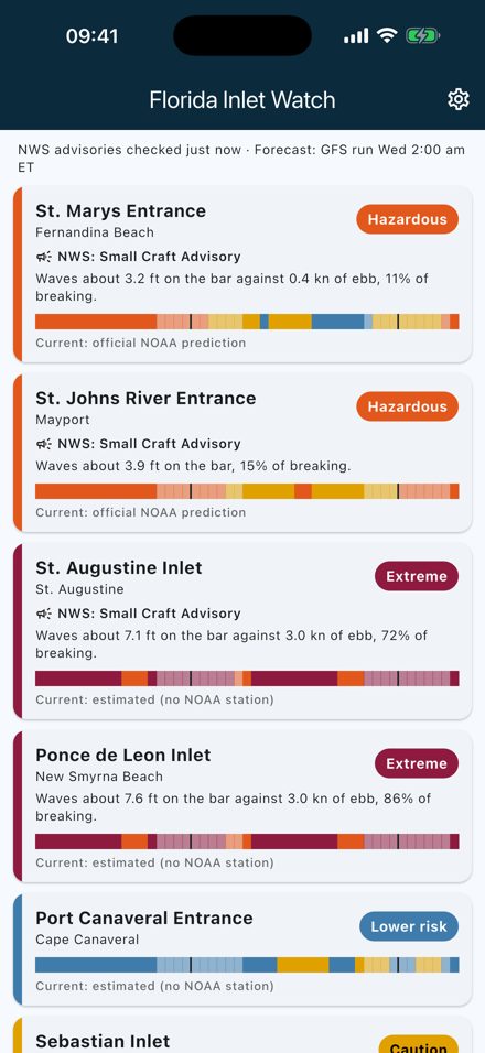
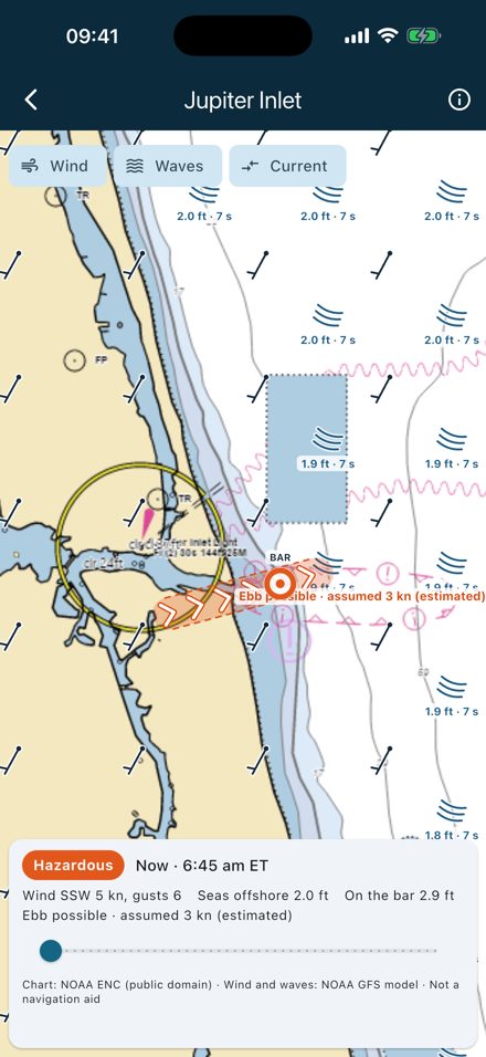
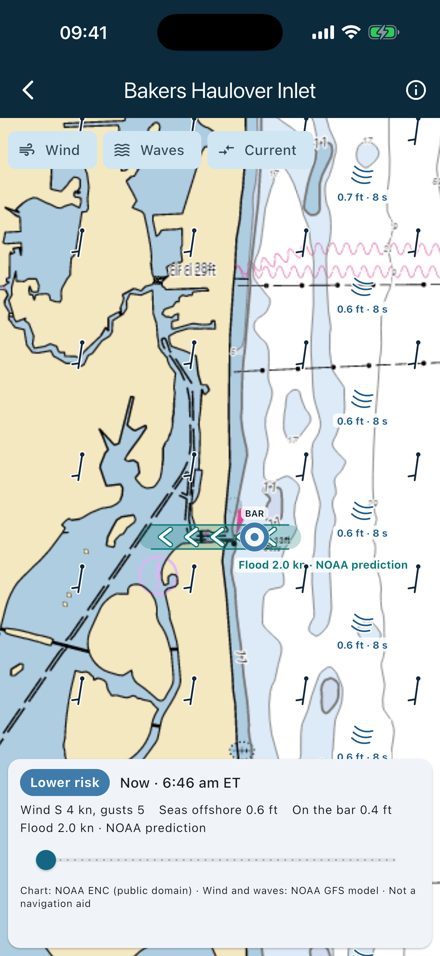
The most dangerous inlet conditions come from an outgoing tide running against waves from the ocean: the current shortens and steepens the waves until they break on the bar. Florida Inlet Watch computes that, hour by hour, for 35 inlets and passes all around Florida — the Atlantic coast, Biscayne Bay and the Keys, and the Gulf coast from Naples to Pensacola — and shows the official National Weather Service advisories next to it.
Inlets and passes
Atlantic coast: St. Marys, St. Johns River, St. Augustine, Ponce de Leon, Port Canaveral, Sebastian, Fort Pierce, St. Lucie, Jupiter, Lake Worth, Boynton, Boca Raton, Hillsboro, Port Everglades, Bakers Haulover, Government Cut.
Biscayne Bay and the Keys: Caesar Creek, Channel Five, Long Key Viaduct, Moser Channel, Bahia Honda Channel, Key West Main Ship Channel.
Gulf coast: Gordon Pass, Captiva Pass, Boca Grande Pass, Gasparilla Pass, Venice Inlet, New Pass, Longboat Pass, Tampa Bay Entrance, Pass-a-Grille, Johns Pass, St. Andrew Bay Entrance, Destin East Pass, Pensacola Pass.
24 of them use official NOAA current predictions. Eleven have no NOAA current station (St. Augustine, Ponce de Leon, Port Canaveral, Sebastian, St. Lucie, Jupiter, Boynton, Boca Raton, Hillsboro, Gordon Pass, Destin East Pass): there the app assumes the ebb may run over a wide window, and says so.
Inlet maps
Each inlet has its own map on the official NOAA nautical chart: wind barbs, wave crests with height and period, and the current running through the inlet, drawn only in the channel — the NOAA prediction where one exists, the wide window when ebb is possible elsewhere. Free: right now. Subscription: any hour of the next 48.
Free and subscription
Free for everyone: the current index of every inlet, official NWS advisories and coastal waters forecast, live buoys and airport winds, today's tides and currents. Subscription: the hour-by-hour 48-hour forecast, ebb, waves on the bar and wind curves, the 48-hour inlet maps, and daylight hours with the lowest index.
How accurate is it?
- Wave forecast vs. the six NOAA buoys along the coast (one week, 6–24 h ahead, 168 comparisons): mean error −0.05 m, typical error 0.18 m, correlation 0.80. When a buoy measures more than forecast, the App raises the forecast; it never lowers it.
- Currents at seven inlets are NOAA's official predictions, used as published.
- Elsewhere, slack follows the tide by −20 to +169 minutes depending on the inlet, so the App does not pretend to know it: it assumes a wide ebb window that covered 99.2–100% of the real ebb at the seven reference inlets — at the cost of extra “Hazardous” hours.
- Wave–current physics: Doppler-shifted dispersion, conservation of wave action, depth- and steepness-limited breaking.
Support
contact@gansoft.ch · Terms of Use · Privacy Policy
Independent app. Not affiliated with or endorsed by NOAA, the National Weather Service or the U.S. Coast Guard.